Author: admin

  • Who is the decision maker when it comes to managing the beach?

    Who is the ultimate decision-maker? 

    The section of beach within the scope of this discussion is wholly within the North Wirral SSSI [site of special scientific interest] (1) Consequently, any activity that affects the habitat must be approved in advance by Natural England. Specifically, it is an offence to carry out any activity that may likely damage the SSSI without consent from the relevant conservation agency. (2) Furthermore the site is also designated as part of the Dee Estuary Special Area of Conservation which grants still higher levels of protection to any habitats classes as Annex 1 under that citation. 

    Why has the management of Hoylake Beach been halted? 

    Natural England’s formal Assent that permitted the management of Hoylake Beach expired on the 31st March 2021. Prior to that, at the end of the 2019 season, they advised against spraying or raking They have not renewed the licence, consequently, it is currently illegal to rake or spray the beach. [3]
    What needs to happen before and raking of the beach can start? 
    Natural England have indicated that it might be possible to replicate the approach they have adopted at Southport, ie. identify an area of the foreshore that can be retained as a managed amenity area, however, they will not agree to anything prior to a comprehensive botanical and geomorphology study. This will identify the least harmful location and determine if the damage resulting to nationally important habitat is justifiable. Nothing can happen without Natural England’s specific say-so.

    Issues to consider:

    If the council were to resume raking without first obtaining permission from Natural England, they would be liable to prosecution and fines.

    EVIDENCE:

    Link to the citation for the North Wirral Foreshore SSSI 
    Link to the Environmental Law covering SSSIs 
    Link to a letter confirming that Assent to rake/spray Hoylake beach has been withdrawn by Natural England, and evidence that raking is likely to result in prosecution of the Council 

  • Dunes or Saltmarsh – changes in plant populations at Hoylake

    Salt marsh or sand dune? What the plants can tell us about the emerging habitats at the Hoylake foreshore.

    Over the past two years, I’ve completed 5 survey visits in total looking at the plant species that grow across Hoylake beach and their relative abundance. Using that very same survey data, I looked at Ellenberg values for salt. These values indicate how tolerant any given plant species is to salt, for example, a species that has a really low Ellenberg salt value of 0 is one that is entirely intolerant to salt. By comparison, species with high Ellenberg salt values at around 7 to 9 indicates that the species is highly adept to survive in brackish environments, like Spartina and Glassworts.

    In early to mid-successional saltmarshes, these are highly brackish environments rich in salt, and the species that live in them indicate that by having high Ellenberg values for salt, just like Spartina (Ellenberg = 7) and Glassworts (Ellenberg value = 9). By comparison, species that live across other coastal habitats, namely sand dunes, that are not regularly inundated by the sea, tend to have very low Ellenberg values. Were Hoylake transitioning into saltmarsh from what was a previously raked beach, the Ellenberg values for salt we would anticipate seeing would be very high. However, were Hoylake transitioning into a dune system, separated from high tides, Ellenberg values would be very low and would probably decline over time.

    This is exactly what we see at the moment at Hoylake. Average Ellenberg values for salt are now not only incredibly low currently (1.5), but they have declined over the past two years and look to be continuing to do so. In addition, plants like Sand Couch and Lyme-grass, sand dune pioneer species, have significantly increased in their abundance across the beach in just two years. Other sand dune specialists not ever found in any recognised saltmarsh community are also now established and widely distributed across the beach, including Marram and Sea Spurge.

    Although some people may think that the Hoylake foreshore might be transitioning to saltmarsh and would not develop into a dune system, the developing vegetation is telling a very different story.

  • What do we mean by Hoylake Beach 

    Strictly speaking, we mean the area covered by the study area covered by LiDAR measurement since 1985 (see the 1st image), though there is benefit in talking about Meols, which is like Hoylake 40-50 years ago, and red Rocks to West Kirby. Both areas were part of the same original dune system, before the north shore was encased in concrete

    The Special Area of Conservation (Internation Protection and purple hashed)) cover The King’s Gap, Alderley and RNLI Slipways, but not Trinity, or Hoyle.

  • Wind direction and dune formation

    What is the relationship between prevailing wind direction and dune formation?

    Dunes will never form at Hoylake because the prevailing wind direction is WSW something I’m hearing a lot. The source of this seems to originate from a Ward councillor and it gets repeated frequently in much the same way as Hoylake will end up like Parkgate, that only makes sense if you fail to apply critical thinking.

    I realise that in-depth science explanations can be hard to wade through – so here is the  TLDR The conditions for dune formation are as perfect as its possible to be at Hoylake. If you don’t fancy the science, skip to the photos at the end with these three questions in your head:

    • (i) Is there evidence that the conditions at Hoylake previously, produced dunes
    • (ii) How does the relationship between the shore orientation and prevailing wind direction at Hoylake compare to other locations with dunes
    • (iii) Do we have more or less exposed sand than other locations that are dune building.

    HERE COMES THE SCIENCY BIT

    96% of sand movement is by saltation, 1% by suspension and 3% by reptation (creep) If you don’t know about saltation yet – look here 

    There are 3 misconceptions that need correcting – two in the linked image and the 3rd on a recent thread. 

    (i) The prevailing wind direction at Hoylake isn’t SW, its WSW and as you will see below, that’s really important

    (ii) The wind needs to be perpendicular to the shore – ie NW at Hoylake for dunes to form. In reality, any onshore wind, even 1 degree from parallel is all you need to form dunes. That 178 degrees out of the wind rose building dunes. What isn’t immediately obvious is that the most effective wind direction for dune building is just onshore. This is because in addition to wind strong enough to get sand moving, you also need to have a long enough path of dry sand to set up saltation – this length varies with wind strength, but it’s around about 100m usually. Because the outer beach is more frequently covered by tides, conditions for establishing saltation are more frequent close to shore, so just onshore winds are the best dune builders, blowing along the dry upper beach, building up a cloud of mobile sand ready to drop on the embryo dunes.

    (iii) The last misconception is that all wind directions are equal when it comes to moving sand. If you recall saltation moves 2 orders of magnitude more than suspension. An offshore wind doesn’t cross 100m of open dry sand in order to set up saltation. Dune grass roots stop reptation, so it’s just suspension that can take sand back out. Of course, further out on the beach saltation can set up. This is why locations with prevailing offshore winds can form dunes – just so it’s clear – less frequent saltating conditions deposit so much more sand than more frequent offshore conditions can remove it. It’s also why beaches with dune backing have a tendency to steepen, something that is measurably happening at Hoylake. The beach line is moving offshore as the sea is moving onshore and eventually, Hoylake might become a swimming location (as opposed to its historical position as a “wallowing” in the gutter location)

    ORIENTATION OF SELECTED NW BEACHES 

    • Hoylake. The Beach faces nearly exactly NW, the prevailing wind is WSW – the ideal direction for saltation.
    • Talacre. The beach faces a little E of North and the prevailing wind is WSW – ie offshore. This of course hasn’t stopped impressive dunes from forming. This as you now know is because though onshore winds are rarer, the amount of sand they deposit is orders of magnitude larger.
    • Birkdale. The orientation is NW – almost identical to Hoylake, and unsurprisingly the prevailing wind is WSW, though there is much less exposed sand. Birkdale is the most apt comparison to Hoylake, not least since it’s 10 years ahead of us in the recovery from mechanical (not sure about chemical) suppression of succession vegetation.
    • Fleetwood. Fleetwood faces a few degree west of north, and so the prevailing WSW wind is offshore and despite there being not very much exposed sand, a lovely low dune system is forming outside the concrete sea wall.
  • Groundwater v Drains

    Groundwater v Drains – study needed

    I had another opportunity to study the water table – following heavy rain a couple of nights ago, there was an initial flow of water from the North Parade drains. This water immediately sunk through the beach. A couple of days later groundwater is showing past the embryo dune ridge.

    I think it’s quite probable that this is another unintended consequence of our ancestors thinking they were doing something useful by draining the carrs behind Hoylake and Meols, but actually they were just saving up problems for the future. Willow is amazingly good at taking groundwater and putting it into the atmosphere by a process called evapotranspiration. 

    Before WBC spend any money fixing our Victorian drains (a multi-million-pound operation) I’d be quite keen to see if there is:-

    (i) any point in doing this

    (ii) if it was possible to come up with a more environmentally friendly solution.

    I think it’s probably worthy of a whole new FB group because there are so many other possible benefits to reviving the idea of establishing a Wildfowl and Wetlands Centre on the Carrs, which at its most ambitions could be a flood abatement scheme for north Wirral, a water treatment option for Hoylake, Meols and parts of West Kirby. And that’s before we get to Beavers and Otters.

    But for now I’ll park it here.

    • A visitor attraction [Burton Mere RSPB attracts 40,000 visitors a year, Washington WWT 83,817, Martin Mere WWT 170,000 Leighton Moss RSPB 100,000 etc]
    • Sustainable water treatment. Eg 1 hectare of Phragmites reed-bed, removes the need to discharge at sea and offers an alternative discharge point to the drains currently discharging onto Hoylake beach [Masi]
    • Reduce flooding in the lower Birket valley through capture, slower release and evapotranspiration of flood and groundwater in the upper Birket [ Marc, Tariq]
    • Reduce groundwater discharge onto the beach at Hoylake by lowering the water table [figure 4]
    • Carbon Net-Zero target – one reed bed system has been shown to reduce CO2 equivalent by 70 tons a year compared to conventional methods[Edie] . The Carbon sequestration rate of woodland is approximately 70t of CO2 equivalent per hectare per year [Gregg et al 2021]
    • Biofuel generation via short rotation coppicing is estimated at 46 MW per hectare per anum a 99.6% in CO2 equivalent reduction per GJ over fossil fuels [Forest Research]
    • Biodiversity gain. Wet Woodland, Reedbeds and Coastal and Floodplain Grazing Marsh are all high priority Biodiversity action plan habitats [JNCC]
    • A research and education facility

    REFERENCES

    van Bussel 2006, The potential contribution of a short-rotation willow plantation to mitigate climate change

    Edie 2020 Ground-breaking reed bed system cuts carbon for Essex & Suffolk Water

    Gregg et al 2021 Carbon storage and sequestration by habitat: a review of the evidence

    Harding 2007The Wirral Carrs and Holms JOURNAL OF THE ENGLISH PLACE-NAME SOCIETY 39 45-57

    Hoylake Village Life 2017 Proposals for a Hoylake Eco-Golf Resort Wildfowl and Wetlands Centre

    Forest Research Potential yields of Biofuels per hectare per annum

    JNCC 2016 List of Biodiversity Action Plan priority habitiats

    Marc, V.; Robinson, M. The long‐term water balance (1972–2004) of upland forestry and grassland at Plynlimon, mid‐Wales. Hydrol. Earth Syst. Sci. 2007, 11, 44–60, doi:10.5194/hess‐11‐44‐2007

    Masi et al 2017Large scale application of French reed beds: Municipal wastewater treatment for a 20,000 inhabitant’s town in Moldova Water Science & Technology 76, 134-146

    Tariq et al 2020 Applied Sciences 10(23):8752 A Critical Review of Flood Risk Management and the Selection of Suitable Measures

  • Time-lapse of accretion 

    This is where I’ve been all week. We’ve split the beach into 360 squares and monitored the levels in each square over time. Using this we’ve been able to generate equations which predict beach height in any year at each location. This means that we can fill in the missing years and missing measurements) The modelled results have an M in the top left corner. This wouldn’t be possible (in less than a month), without the help of Elina Thomassonand her astounding ability to code. At one point today I had over 70 spreadsheets open. Now we can generate a map or a prediction in a few minutes. The models are a lot smoother than the real data – they don’t have the local fluctuations in levels that the raw data has

    Aside from the smoothness, they are hard to tell from the raw data and the significant features are all recorded correctly.

    Enjoy – this was a labour of love!

    Use pause if it goes too fast for you!

  • Is the beach safe beyond the grass [Kings Gap to the Lifeboat Station]

    Is it safe to go out on the beach beyond the grass.

    Some people have suggested that it is dangerous to venture out onto Hoylake beach. 

    The advice from the coastguards is that there are no specific dangers, 

  • Risk 17 Perception of poor climate change outcomes for Spartina

    Risk 17: Preliminary risk assessment around climate impact of allowing the green beach to develop or returning to raking.

    Headline: There are strongly positive climate change benefits if saltmarsh develops, and we can anticipate approximately half the benefits if dunes develop and negligibly small negatives if raking resumes.

    This assessment looks into concerns that despite indications to the contrary, Spartina-rich saltmarsh, as opposed to dunes, will form and further concerns that Spartina may have a negative effect on climate change. 

    Methane is released when plants decay and are digested underground in conditions of very low oxygen, by anaerobic bacteria. (Wang et al 2017) Fortunately, these bacteria are inhibited, or more accurately outcompeted by sulphate-reducing bacteria in brackish conditions such as saltmarshes. Recently an alternative route for methane production has been identified in green plants. There is still some uncertainty about the biochemical pathway involved, but there is evidence that methane is released in response to stress, like trampling or cutting. (Wang 2009).

    Studies in China and Australia have identified increases in methane production following the colonisation of bare mudflats by Spartina, with an increase in aerobic methane production by around an order of magnitude (10x as much) (Yuan et al 2019, Gao et al 2018) This finding has caused alarm amongst some people, yet saltmarsh is still advocated by climate change scientists as an important tool in the fight to achieve climate change targets (Rosentreter et al 2021 Bertonlini & Mosto 2021) Even in Australia, where Spartina is classed as a damaging invasive species, the decision to remove is not simple (Kennedy et al. 2018) This despite Methane having around 80x the effect of Carbon Dioxide in terms of the greenhouse effect. The primary purpose of this post is to explain why this is.

    .

    Why do climate change scientists advocate the use of saltmarsh to combat climate change despite methane production?

    The two figures show a simplified and a more detailed illustration of the pathways involving methane and carbon dioxide around saltmarshes. The main thing to notice is that the amount methane production is tiny, whilst the amount carbon sequestration is huge. The measurements quoted in (Yuan et al 2019) are 6 μmol per kg ofSpartina whilst the figured for carbon capture eg from (Beaumont et al 2013) is measured as 2-3 tons per hectare per year. (Burden et al 2019) There are different volumes and timescales here, so a little work is needed to compare them directly, but the fact that one is quoted in μmols, which are a count of the number of molecules, and the other is measured in tons, is a good indication.

    This is working out if anyone wants to check it.

    • 6μmol per kg of grass per day is 2190μmol a year 
    • The average weight of Spartina per square meter is 750g so we can say 1642 μmol per square meter per year. Knowing the density of methane, it’s then possible to work out both the weight ( 0.0351 grams) of methane and its volume 0.05 litres per year (figure 3). As aside a cow produces up to 500 a day. A typical Spartina clump is about 1 square meter in size.
    • A hectare is 10,000 square meters:
    • Thus a hectare of continuous spartina saltmarsh could produce 3.51Kg of Methane a year while it captures 2.42 tons of carbon dioxide. Methane is oxidised to Carbon Dioxide in the atmosphere and has on average less than 10x the life span (IPCC 2021.) This is why saltmarshes are seen as so important in the battle against climate change.

    Dunes and raking

    The carbon sequestration and storage capacity of dunes is approximately half that of salt marshes (Beamont 2013, Drius 2017)

    There may be some release of already captured carbon as Methane if raking resumes, the volume of which will depend on how the organic material above and especially below the surface is treated after it is destroyed. Aerobic/anaerobic conditions and salinity being the most important factors. This could be mitigated if the decision to dig up the green beach is taken.

    .

    REFERENCES

    Beaumont et al 2013 The value of carbon sequestration and storage in coastal habitats 

    Bertonlini & Mosto 2021 Restoring for the climate: a review of coastal wetland restoration research in the last 30 years 

    Burden et al 2019 Effect of restoration on saltmarsh carbon accumulation in Eastern England 

    Drius et al 2016 The role of Italian coastal dunes as carbon sinks and diversity sources. A multi-service perspective 

    Gao et al 2018 Exotic Spartina alterniflora invasion increases CH4 while reduces CO2 emissions from mangrove wetland soils in southeastern China 

    Hussey et al 1982 Seasonal Changes in Weight of Above- and Below-Ground Vegetation and Dead Plant Material in a Salt Marsh at Colne Point, Esse

    IPCC 2021 

    Kennedy et al. 2018 Invasive cordgrass (Spartina spp.) in south-eastern Australia induces island formation, salt marsh development, and carbon storage 

    Yuan et al 2019 Spartina alterniflora invasion drastically increases methane production potential by shifting methanogenesis from hydrogenotrophic to methylotrophic pathway in a coastal marsh 

    Rosentreter et al 2021, Half of global methane emissions come from highly variable aquatic ecosystem sources  

    Kroeger et al 2017 Restoring tides to reduce methane emissions in impounded wetlands: A new and potent Blue Carbon climate change intervention. 

    Wang et al 2009 Physical injury stimulates aerobic methane emissions from terrestrial plants 

    Wang et al 2017 Identifying the salinity thresholds that impact greenhouse gas production in subtropical tidal freshwater marsh soils 

  • Is leaving the beach to nature attracting more Rats?

    A freedom of information act was requested from the beginning of 2017 (prior to Wirral Borough Council (WBC) stopping herbicide treatment on the beach), and different areas of the Wirral were ranked based on the number of call outs for WBC rat control service.

    West Kirby was ranked top with 32 call outs, whereas Hoylake was ranked 22nd with 10. Neston and Parkgate are not part of WBC, but the closest area to Parkgate on the list, Gayton, had just five call outs (Liverpool Echo, 2018).

    Confounding factors may include the size of gardens, being aware of pest control council services and being able to afford them. A study by Lambert et al (2017) identified the following risk factors for rats and mice reported on or near dwellings ‘including litter around the dwelling, pets and/or livestock in the garden, drainage faults, housing density, the urban-rural nature of the area and tenure type’. In addition, the data do not include private pest control companies, but does provide a comparison of Council treatment service requests across the area. 

    Rats are predominantly found in densely human populated areas where they can gain easy access to food (Frei, 2019 and Tamayo-uria et al, 2014). Older houses, more densely populated houses, and houses closer to vegetated areas, markets and cat feeding stations had higher risks of rat infestations (Tamayo-uria et al, 2014).

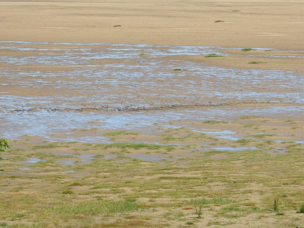
    In addition to built up areas, rats can also be found along river beds, near areas of human agriculture, and other areas such as near trees (Traweger et al, 2006 and Modlinska and Pisula, 2020). However, when examining trapping success of rats within different soil types, rats were found less often in sand compared to other soil types and when running, standing, or no water sites were compared, fewer rats were trapped in standing water sites (Traweger et al, 2006). Rats can build extensive tunnel networks (Modlinska and Pisula, 2020), therefore making sand a less suitable environment to build tunnels in. 

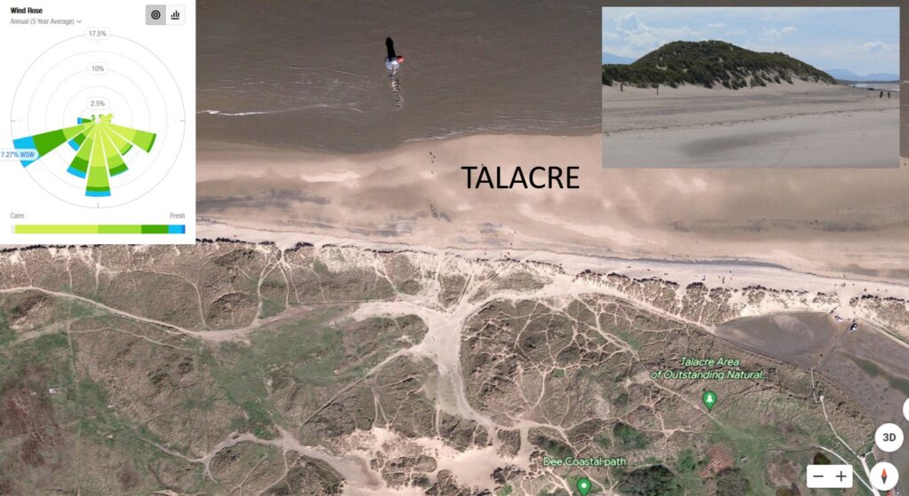
    Factors which limit Rat movement include having to cross roads, waterways, and areas which are resource poor (Byers et al, 2019). Rats have recently been spotted on New Brighton beach, demonstrating that they can be found in a beach environment, however this is thought to be related to litter on the beach (Liverpool Echo, 2021). Rats are omnivores and will eat a variety of food including nuts, wheat, meat, cheese, chocolate and are often attracted to human rubbish, compost and bird feeding areas (Jackson, 2016; Barnett, 1956; BPCA, 2021 and Modlinska and Pisula, 2020). Milk chocolate, walnuts, Nutella and cheese have been identified as some of the most successful foods to attract rats into traps (Jackson, 2016).

    Rats can be reservoirs of zoonotic diseases (diseases which can pass from animals to humans), and can also cause damage to houses, such as biting through electrical cables and insulation (BPCA, 2021). Therefore the risks of attracting rats into the home need to be considered. 

    In conclusion, rats can pose a problem to homes, although measures can be taken to reduce the risk of attracting rats, such as using compost containers which can’t be accessed by rats, keeping rubbish in containers, and making sure any bird feed is not accessible from the ground. There are limited data on the prevalence of rats found on beaches, although when they have been recorded in these environments, they usually coincide with the presence of litter, and rats are less inclined to cross roads than other animals. What’s more, rats often live in extensive tunnel systems, which makes a sand/beach environment less preferable for a living space. This suggests that human homes are still the most preferred environment for rats compared to a beach environment, especially one which is separated from homes by a road. 

    It is unknown how rats may interact with the beach environment in the future, so this needs to be continually monitored, especially if litter increases. There is also a lack of current data on the current numbers of rats in Hoylake and on the beach, so further research is needed. 

    References

    Liverpool Echo (2018) Wirral’s rat capitals ranked – and the result is a big surprise. Accessed 12th August 2021, available at https://www.liverpoolecho.co.uk/news/liverpool-news/wirrals-rat-capitals-ranked-result-15045663

    Lambert, M., Vial, F., Pietravalle, S. and Cowan, D., (2017). Results of a 15-year systematic survey of commensal rodents in English dwellings. Scientific reports, 7(1), pp.1-12. Available at https://www.nature.com/articles/s41598-017-15723-9 

    Lukas Frei (2019) Rat City: Visualizing New York City’s Rat Problem. Accessed 12th August 2021. Available at https://towardsdatascience.com/rat-city-visualizing-new-york-citys-rat-problem-f7aabd6900b2 

    Tamayo-Uria, I., Mateu, J., Escobar, F. and Mughini-Gras, L., (2014). Risk factors and spatial distribution of urban rat infestations. Journal of Pest Science, 87(1), pp.107-115. Available at https://www.researchgate.net/publication/260528748_Risk_factors_and_spatial_distribution_of_urban_rat_infestations 

    Traweger, D., Travnitzky, R., Moser, C., Walzer, C. and Bernatzky, G., (2006). Habitat preferences and distribution of the brown rat (Rattus norvegicus Berk.) in the city of Salzburg (Austria): implications for an urban rat management. Journal of Pest Science, 79(3), pp.113-125. Available at https://www.researchgate.net/publication/225479841_Habitat_preferences_and_distribution_of_the_brown_rat_Rattus_norvegicus_Berk_in_the_city_of_Salzburg_Austria_Implications_for_an_urban_rat_management

    Modlinska, K. and Pisula, W., 2020. The natural history of model organisms: The Norway rat, from an obnoxious pest to a laboratory pet. Elife, 9, p.e50651. Available at https://elifesciences.org/articles/50651 

    Byers, K.A., Lee, M.J., Patrick, D.M. and Himsworth, C.G., (2019). Rats about town: a systematic review of rat movement in urban ecosystems. Frontiers in Ecology and Evolution, 7, p.13. Available at https://www.frontiersin.org/articles/10.3389/fevo.2019.00013/full 

    Liverpool Echo (2021) ‘Boy terrified to go back to beach where rats ‘were coming onto the sand’. Accessed 14th August 2021, available at https://www.liverpoolecho.co.uk/news/liverpool-news/boy-terrified-go-back-beach-21307337 

    Jackson, M., Hartley, S. and Linklater, W., 2016. Better food-based baits and lures for invasive rats Rattus spp. and the brushtail possum Trichosurus vulpecula: a bioassay on wild, free-ranging animals. Journal of Pest Science, 89(2), pp.479-488. Available at http://explore.bl.uk/primo_library/libweb/action/display.do?tabs=detailsTab&gathStatTab=true&ct=display&fn=search&doc=ETOCRN377600834&indx=1&recIds=ETOCRN377600834 

    Barnett, S.A., 1956. Behaviour components in the feeding of wild and laboratory rats. Behaviour, 9(1), pp.24-43. Available at https://brill.com/view/journals/beh/9/1/article-p24_2.xml 

    British Pest Control Association (BPCA) (2021) ‘Pest advice for controlling Brown Rats’. Accessed 15th August 2021. Available at https://bpca.org.uk/a-z-of-pest-advice/brown-rat-control-how-to-get-rid-of-brown-rats-bpca-a-z-of-pests/189176

  • What new plants have been discovered on Hoylake Beach?

    NB. This will develop with time!

    Sea Rocket Cakile maritima 11th August 2021 , photgraphed by Maureen Hansonen Hanson 

    Sea Spurrey (presumed Lesser Spergularia marina) Taken by Kate Rice near Kings Gap on July 10th 2021 

    Glasswort sp Salicornis sp Taken by Kate Rice in June 2921 

    Rock Samphire Crithmum maritimum 10th August 2021 by Laura Higginbottom 

    Sea Mayweed Tripleurospermum maritimum 10th August 2021 by