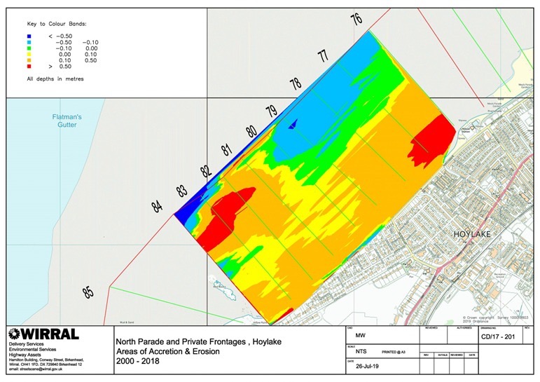
Strictly speaking, we mean the area covered by the study area covered by LiDAR measurement since 1985 (see the 1st image), though there is benefit in talking about Meols, which is like Hoylake 40-50 years ago, and red Rocks to West Kirby. Both areas were part of the same original dune system, before the north shore was encased in concrete
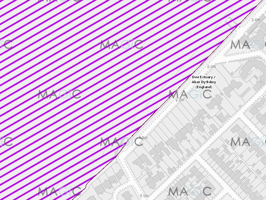
The Special Area of Conservation (Internation Protection and purple hashed)) cover The King’s Gap, Alderley and RNLI Slipways, but not Trinity, or Hoyle.